

The Mariana Trench · 10,935 metres
トレンチへようこそ 地球上で最も深い海溝は、185 km の沖合に位置しています。
スクロールして潜ってみましょう。下っていく途中に出会うものはすべて実在し、見つかった深さであなたを待っています。
-
0 m0 ftマリアナ諸島にて
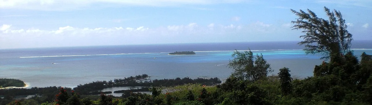
Saipan ラグーン
The descent begins in the sunlit shallows on Saipan's western shore, where a barrier reef shelters a lagoon in three parts: Tanapag, Garapan and Chalan Kanoa. At the surface the only pressure is the weight of the air, one atmosphere.
Marianas Visitors Authority — Official Marianas Guide Course Manual (2018), reefs and barrier lagoon · Frontiers in Microbiology (2020) — Sinigalliano et al., description of the Saipan Lagoon regions · NOAA National Ocean Service — How does pressure change with ocean depth?
A. Legra · CC BY-SA 3.0 · Resized to at most 1200 pixels wide, converted to WebP and compressed; CSS display cropping may apply. 写真のクレジットとライセンス -
2 m7 ftマリアナ諸島にて
マニャガハ沖のサンゴ礁生物
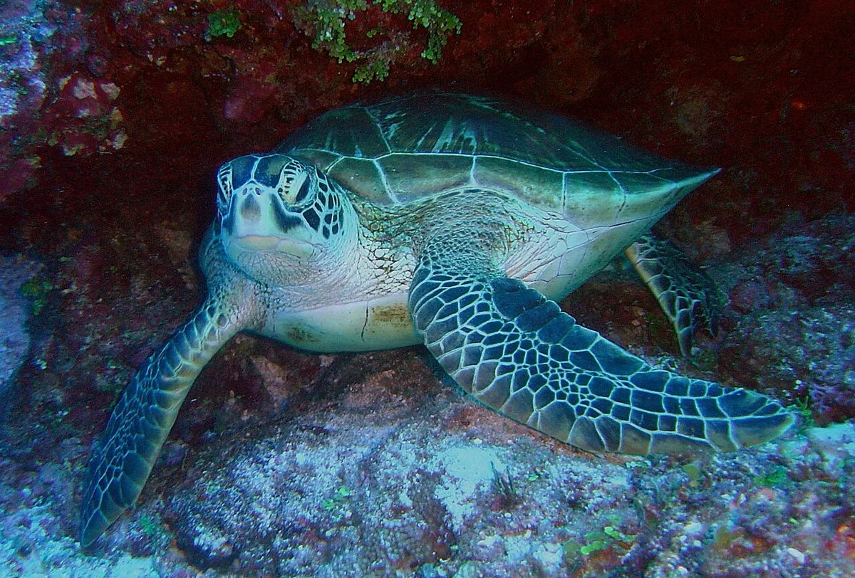
A metre or two down, the reefs around Mañagaha, a no-take marine sanctuary in the lagoon, are where many visitors snorkel among Saipan's reef fish. One of the most conspicuous is the steephead parrotfish, which scrapes algae from dead coral with teeth fused into a beak; spotted eagle rays feed over the lagoon's sand, and green sea turtles live in these waters. From August to November schools of young atulai, the bigeye scad, move inside the reef.
CNMI DCRM — 2025 Shoreline Public Access Guide, Mañagaha Island (page 25) and marine protected areas (page 10) · Marianas Visitors Authority — Official Marianas Guide Course Manual (2018), CNMI marine life (manual pages 60–66)
参考写真。 Saipan で撮影されたものであり、その出典には場所や深さについての記載はありません。 David Burdick / NOAA Photo Library · CC BY 2.0 · Resized to at most 1200 pixels wide, converted to WebP and compressed; CSS display cropping may apply. 写真のクレジットとライセンス -
7 m23 ftマリアナ諸島にて
「エミリー」飛行艇
A Japanese Kawanishi H8K flying boat, code-named 'Emily' by the Allies, lies upside down and broken apart on the sand in about 7 m of water in Tanapag Lagoon, with all four of its engines still on the site. It is one stop on the underwater heritage trail of the 1944 Battle of Saipan, whose other aircraft, landing craft and ships rest between about 3 m and 11 m down.
Journal of Maritime Archaeology (2024) — McKinnon & Yamafune, monitoring surveys of WWII sites in Saipan's lagoon · Marianas Visitors Authority — Dive Spots: Maritime Heritage Trail, Battle of Saipan
-
9 m30 ftマリアナ諸島にて
The Grotto
At Marpi on the northeast coast, the roof of a limestone cavern fell in and left a sinkhole about 30 m (100 ft) across and as deep, with a seawater pool at the bottom reached by a steep stairway. The Marianas Visitors Authority's guide manual puts the pool at roughly 6 to 9 m (20 to 30 ft) deep; three submerged tunnels link it to the open ocean.
Marianas Visitors Authority — Official Marianas Guide Course Manual (2018), The Grotto (manual pages 76–77) · CNMI DCRM — 2025 Shoreline Public Access Guide, Grotto (page 28) · U.S. Geological Survey — The Grotto, an underwater limestone cavern on Saipan
-
40 m131 ftそれ以外の海域では
Limit of recreational scuba
Dives to 40 m (130 ft) count as recreational scuba; anything deeper is technical diving, with special training and gas mixtures. Pressure rises by about one atmosphere for every 10 m of water, so a diver here is under roughly five atmospheres.
NOAA Ocean Exploration — Technical Diving · PADI — Deep Diver course · NOAA National Ocean Service — How does pressure change with ocean depth?
-
200 m656 ftそれ以外の海域では
夕暮れのゾーンが始まります
Past about 200 m too little sunlight remains for photosynthesis, and the sunlit zone gives way to the twilight zone. The water has turned cold, since the deep ocean averages about 4 °C, and the pressure here is about 21 atmospheres.
NOAA National Ocean Service — How far does light travel in the ocean? · NOAA Ocean Exploration — How does the temperature of ocean water vary? · NOAA National Ocean Service — How does pressure change with ocean depth?
-
420 m1,378 ftマリアナ諸島にて
硫黄の釜、大黒
Near the top of Daikoku, a submarine volcano about 700 km north of Saipan, scientists found a pit of molten sulfur in May 2006: a black, crusted, convecting pool about 4.5 m long and 3 m wide, measured at 187 °C under more than 40 atmospheres of pressure. It lies roughly 420 m down, and flatfish live in large numbers on the sulfur-coated slopes around it.
NOAA Ocean Exploration — Submarine Ring of Fire 2006, Discovery of the Sulfur Cauldron at Daikoku Volcano (May 4 log) · NOAA Ocean Exploration — Submarine Ring of Fire 2006, mission summary · U.S. Geological Survey — Daikoku Seamount · NOAA Ocean Exploration — 2016 Deepwater Exploration of the Marianas, Three Dives at Active Submarine Volcanoes
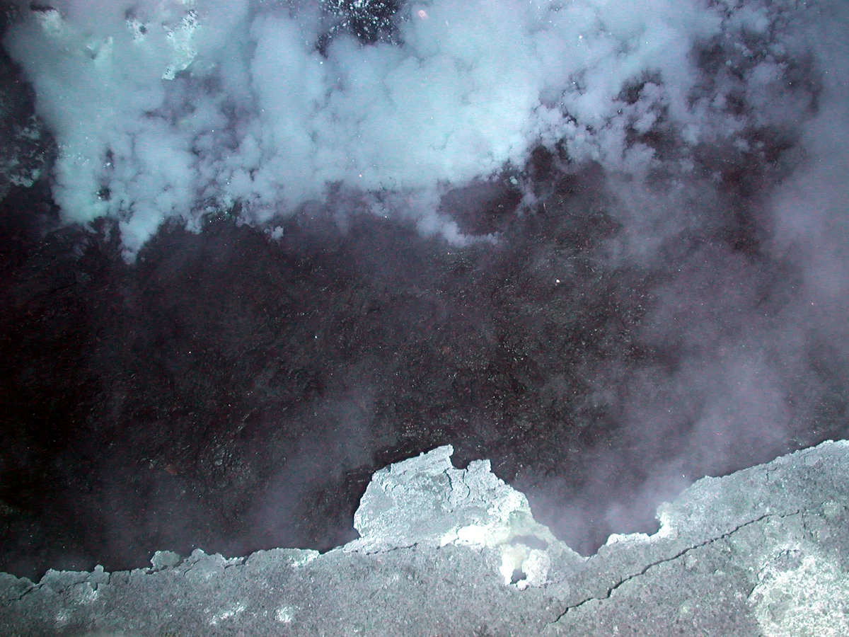
Image courtesy of Submarine Ring of Fire 2006 Exploration, NOAA Vents Program · Public domain · Resized to at most 1200 pixels wide, converted to WebP and compressed; CSS display cropping may apply. 写真のクレジットとライセンス -
560 m1,837 ftマリアナ諸島にて
ブリムストーン・ピット、北西 Rota-1
At NW Rota-1, a submarine volcano in the Mariana Arc, the remotely operated vehicle Jason hovered a few metres from an erupting vent called Brimstone Pit in April 2006 and filmed glowing red lava, ash and gas bursting out under 560 m of water. The weight of the water damps the explosions, which is why an eruption first seen in 2004 could be watched at such close range.
NOAA Ocean Exploration — Submarine Ring of Fire 2006, Close to the Fire (April 29 log) · NOAA Ocean Exploration — Submarine Ring of Fire 2004, April 1 log
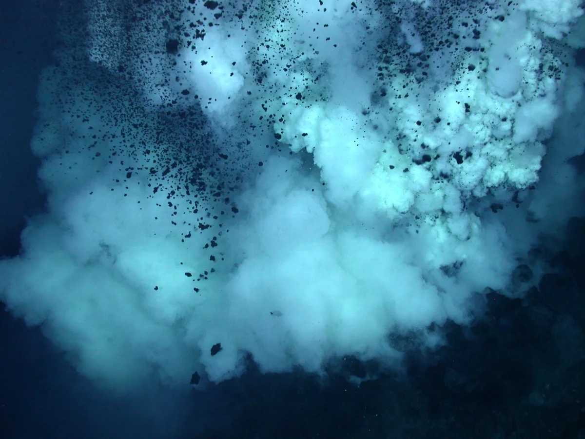
Image courtesy of Submarine Ring of Fire 2006 Exploration, NOAA Vents Program · Public domain · Resized to at most 1200 pixels wide, converted to WebP and compressed; CSS display cropping may apply. 写真のクレジットとライセンス 440 m further down
1,000 m3,281 ftそれ以外の海域では
Midnight zone begins
No sunlight reaches below 1,000 m. From here to the seafloor the only light is made by living things, and the pressure has passed 100 atmospheres.
NOAA National Ocean Service — How far does light travel in the ocean? · NOAA Ocean Exploration — How is light distributed in the ocean? · NOAA Ocean Exploration — How does pressure impact animals in the ocean?
600 m further down
1,600 m5,249 ftマリアナ諸島にて
シャンパン・ヴェント、北西の栄福
Near the summit of NW Eifuku volcano, small white chimneys release 103 °C fluid while cold droplets of liquid carbon dioxide seep out of the surrounding seafloor and rise like bubbles in a glass. When the site was found in 2004, liquid carbon dioxide had been seen venting at only one other place, the Okinawa Trough.
NOAA Pacific Marine Environmental Laboratory — Lupton et al. (2006), Submarine venting of liquid carbon dioxide on a Mariana Arc volcano · NOAA Ocean Exploration — Submarine Ring of Fire 2004, April 10 log · NOAA Ocean Exploration — Submarine Ring of Fire 2006, May 8 log
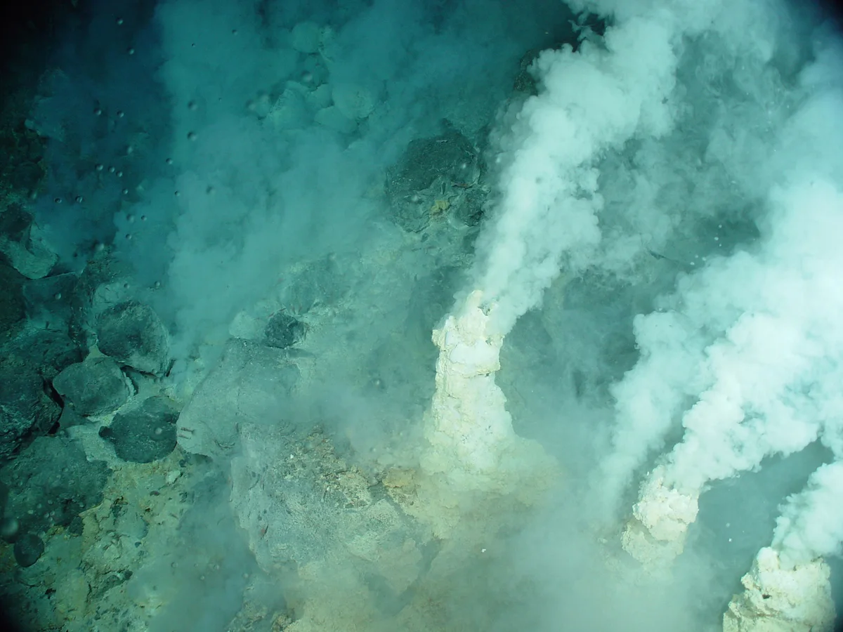
Image courtesy of Submarine Ring of Fire 2004 Exploration, NOAA Vents Program · Public domain · Resized to at most 1200 pixels wide, converted to WebP and compressed; CSS display cropping may apply. 写真のクレジットとライセンス 500 m further down
2,100 m6,890 ftそれ以外の海域では
ダンボオクトパス
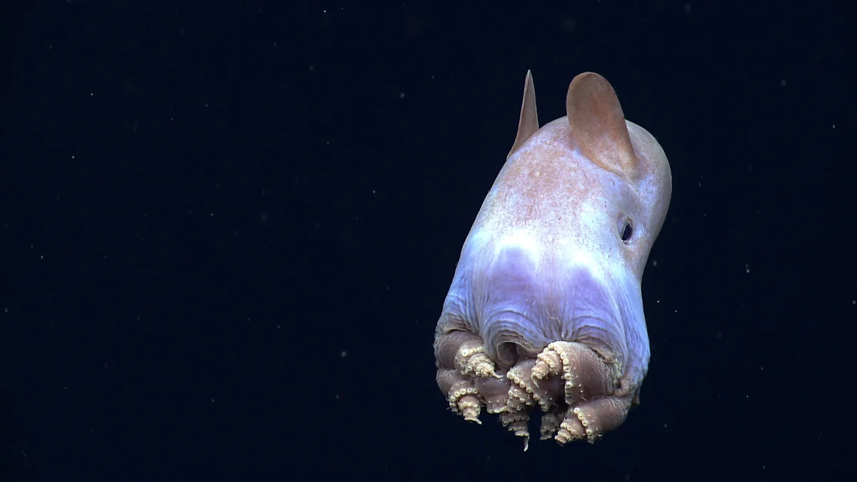
Dumbo octopuses, the genus Grimpoteuthis, are named for the ear-like fins on the sides of the body, which they flap to lift off the seafloor. NOAA's Okeanos Explorer filmed one in April 2014 in the Gulf of Mexico, on a dive that worked between 2,187 m and 1,962 m, coiling its arms into tight spirals, a posture no one had recorded before. Until 2020 the deepest reliable record of any cephalopod was a related finned octopus photographed at 5,145 m.
NOAA Ocean Exploration — Exploration of the Gulf of Mexico 2014, Dumbos and Bobtails and Squids (April 30 log) · NOAA Ocean Exploration — Exploration of the Gulf of Mexico 2014, Dive 13 daily update · Marine Biology (2020) — Jamieson & Vecchione, First in situ observation of Cephalopoda at hadal depths
参考写真。 Taken in the Gulf of Mexico, not in the Marianas and not at this depth. Image courtesy of the NOAA Office of Ocean Exploration and Research, Exploration of the Gulf of Mexico 2014 · Public domain · Resized to at most 1200 pixels wide, converted to WebP and compressed; CSS display cropping may apply. 写真のクレジットとライセンス 400 m further down
2,500 m8,202 ftマリアナ諸島にて
初めて生きた姿が目撃されたゴーストフィッシュ
On 1 July 2016, about 2,500 m down on a ridge some 620 km north of Saipan, NOAA's remotely operated vehicle Deep Discoverer filmed a fish about 10 cm long with transparent, scaleless skin and small eyes without pigment. It belongs to the family Aphyonidae, and no fish of that family had ever been seen alive.
NOAA Ocean Exploration — 2016 Deepwater Exploration of the Marianas, Dive 14 daily update · NOAA Ocean Exploration — 2016 Deepwater Exploration of the Marianas, expedition summary
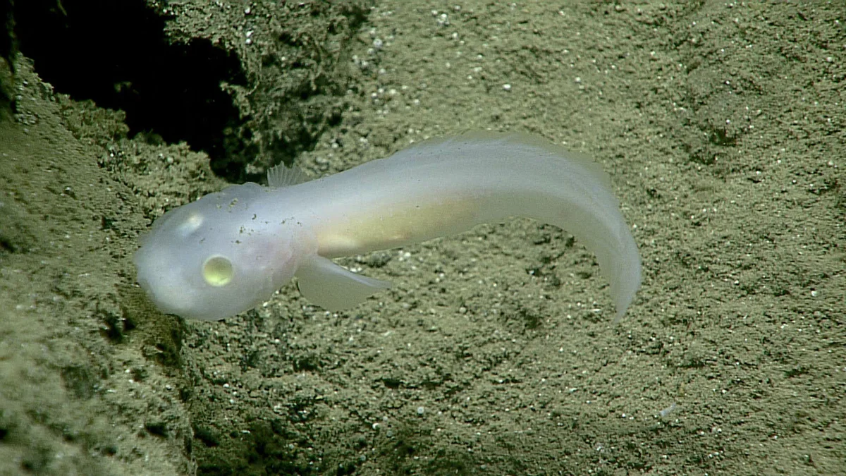
Image courtesy of the NOAA Office of Ocean Exploration and Research · Public domain · Resized to at most 1200 pixels wide, converted to WebP and compressed; CSS display cropping may apply. 写真のクレジットとライセンス 793 m further down
3,293 m10,804 ftマリアナ諸島にて
A 30-metre black smoker
About 220 km north-northwest of Saipan, on the Mariana back-arc spreading centre, Deep Discoverer descended to 3,293 m on 2 May 2016 and met a chimney 30 m tall pouring out black, mineral-laden fluid measured at 339 °C. Shrimp, crabs, snails and anemones crowd the chimney in bands, each kind keeping its own distance from the heat.
NOAA Ocean Exploration — 2016 Deepwater Exploration of the Marianas, Dive 11 daily update · NOAA Ocean Exploration — EX1605 Leg 1 Dive 11 summary (position and maximum depth) · NOAA Ocean Exploration — 2016 Deepwater Exploration of the Marianas, expedition summary
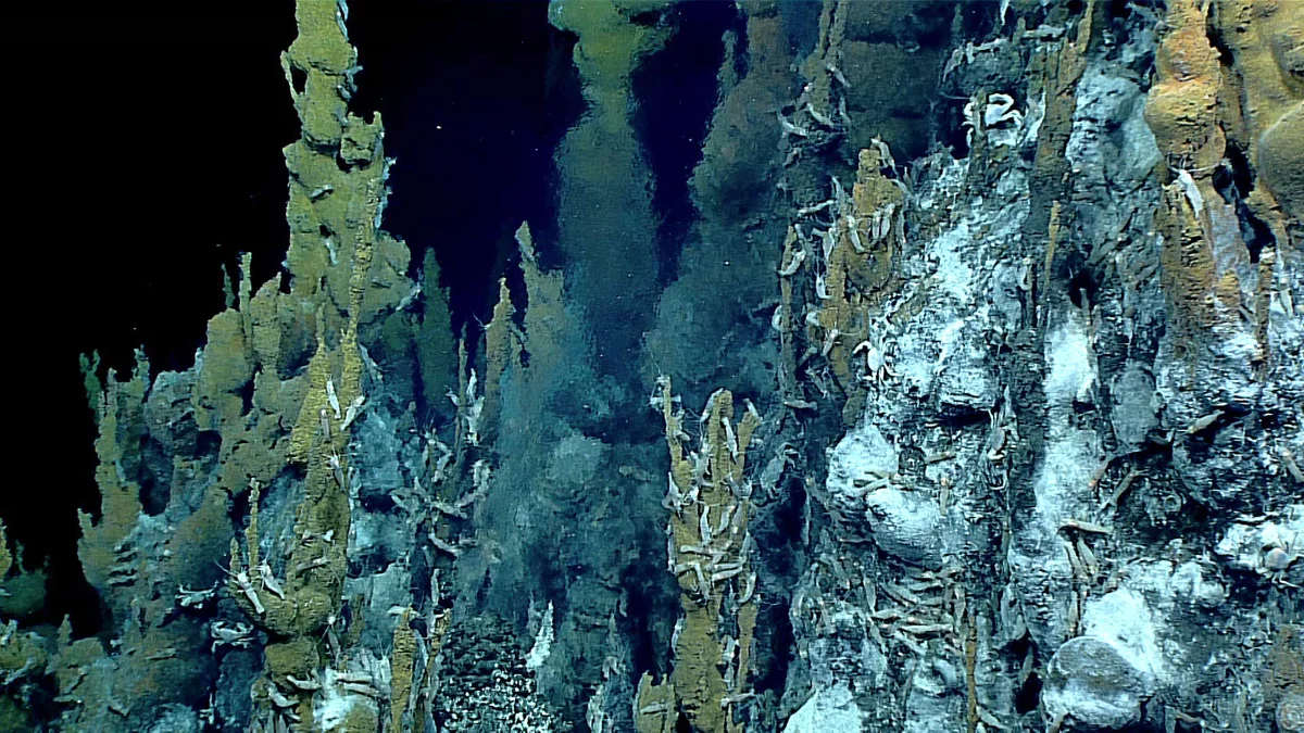
Image courtesy of the NOAA Office of Ocean Exploration and Research, 2016 Deepwater Exploration of the Marianas · Public domain · Resized to at most 1200 pixels wide, converted to WebP and compressed; CSS display cropping may apply. 写真のクレジットとライセンス 369 m further down
3,662 m12,014 ftマリアナ諸島にて
蛇紋岩泥火山
East of Saipan, between the island and the trench, the seafloor carries serpentinite mud volcanoes as much as 50 km across and 2,000 m high, built of mud that rises along deep faults from the plate boundary below. NOAA made the first dive on one of them, Kunanaf Hulo, about 175 km east-northeast of Saipan, on 4 May 2016, starting on its summit ridge at 3,662 m. No active seeps turned up, but the sediment held animals including a hermit crab that carries a living anemone in place of a shell.
NOAA Ocean Exploration — The Geology of the Mariana Convergent Plate Region · NOAA Ocean Exploration — 2016 Deepwater Exploration of the Marianas, Dive 13 daily update · NOAA Ocean Exploration — EX1605 Leg 1 Dive 13 summary (position and depths)
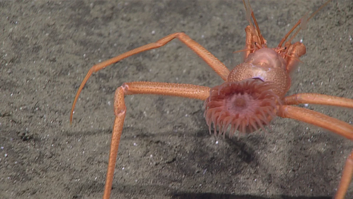
Image courtesy of the NOAA Office of Ocean Exploration and Research, 2016 Deepwater Exploration of the Marianas · Public domain · Resized to at most 1200 pixels wide, converted to WebP and compressed; CSS display cropping may apply. 写真のクレジットとライセンス -
3,682 m12,080 ftそれ以外の海域では
海洋の平均的な深さ
The ocean's average depth is about 3,682 m, a figure worked out in 2010 by scientists from NOAA and Woods Hole Oceanographic Institution using satellite measurements. The Challenger Deep is still almost three times as far down.
NOAA National Ocean Service — How deep is the ocean? · NOAA Ocean Exploration — How deep is the ocean?
-
3,700 m12,139 ftマリアナ諸島にて
エニグマ海山クラゲ
On 24 April 2016, about 3,700 m down beside a seamount informally named Enigma, south of Guam, Deep Discoverer filmed a jellyfish holding its long tentacles outstretched and its bell still, apparently waiting in ambush. Scientists placed it in the genus Crossota; red canals and bright yellow organs, probably gonads, showed through the bell.
NOAA Ocean Exploration — 2016 Deepwater Exploration of the Marianas, Dive 4 daily update · NOAA Ocean Exploration — 2016 Deepwater Exploration of the Marianas, New Discoveries for Managers and Scientists (May 11 log) · NOAA Ocean Exploration — EX1605 Leg 1 Dive 4 summary (position and depths)
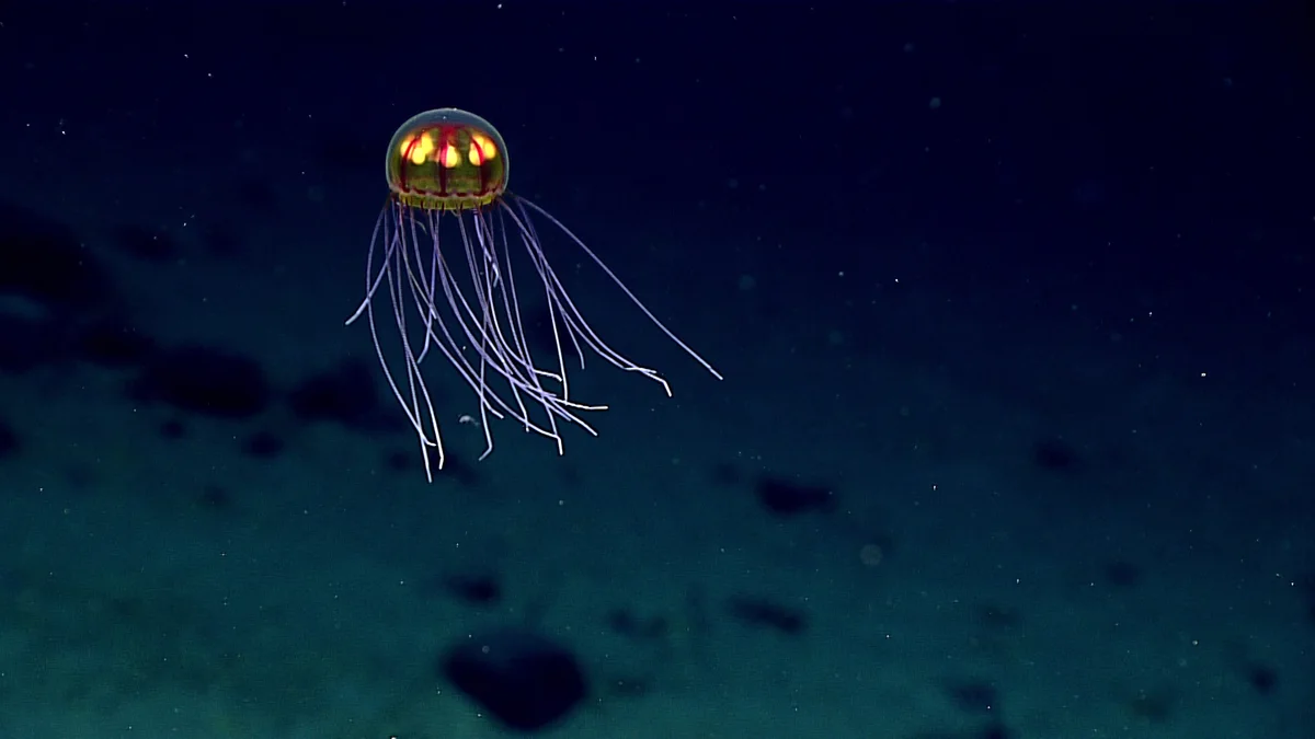
Image courtesy of NOAA Office of Ocean Exploration and Research, 2016 Deepwater Exploration of the Marianas · Public domain · Resized to at most 1200 pixels wide, converted to WebP and compressed; CSS display cropping may apply. 写真のクレジットとライセンス 300 m further down
4,000 m13,123 ftそれ以外の海域では
The abyss
From 4,000 m to 6,000 m lies the abyssal zone, where the pressure climbs from about 400 to about 600 atmospheres. Only about five percent of the food made in the sunlit water above sinks as far as the ocean floor, so life is thinly spread.
NOAA National Ocean Service — How far does light travel in the ocean? · NOAA Ocean Exploration — How is light distributed in the ocean? · NOAA Ocean Exploration — How does pressure impact animals in the ocean?
2,000 m further down
6,000 m19,685 ftマリアナ諸島にて
Hadal zone: into the trench
The deepest zone, the hadal, begins at 6,000 m and is found in ocean trenches; the pressure is about 600 atmospheres. On 21 June 2016 Deep Discoverer reached this depth, its working limit, on the inner wall of the Mariana Trench about 600 km north of Saipan and climbed past pale layered cliffs that reminded the scientists of the Alps. Off Saipan itself the seafloor first drops this deep about 125 km to the east, and the axis of the trench passes about 185 km away to the east-southeast.
NOAA Ocean Exploration — 2016 Deepwater Exploration of the Marianas, Dive 4 (Hadal Ridge) daily update · NOAA Ocean Exploration — 2016 Deepwater Exploration of the Marianas, In the Shadow of the Mariana Trench (May 7 log) · NOAA National Centers for Environmental Information — ETOPO 2022 15 arc-second global relief model (bathymetry used for the distances) · NOAA National Ocean Service — How far does light travel in the ocean?
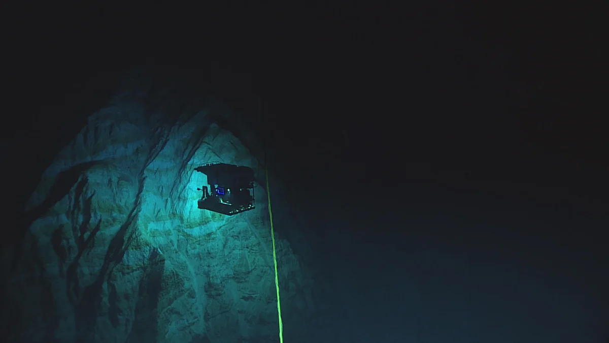
Image courtesy of the NOAA Office of Ocean Exploration and Research, 2016 Deepwater Exploration of the Marianas · Public domain · Resized to at most 1200 pixels wide, converted to WebP and compressed; CSS display cropping may apply. 写真のクレジットとライセンス 957 m further down
6,957 m22,825 ftそれ以外の海域では
記録上最深部に生息するタコ
The deepest reliable record of any cephalopod, the group that includes octopuses and squids, is a dumbo octopus, Grimpoteuthis, filmed by a baited camera lander at 6,957 m in April 2019. It was made in the Java Trench in the Indian Ocean, not in the Marianas. Older trawl reports of octopuses from 7,280 m and 8,100 m in other trenches are treated as doubtful, because the open nets could have caught the animals on the way down or up.
528 m further down
7,485 m24,557 ftマリアナ諸島にて
マリアナ海溝オニギス
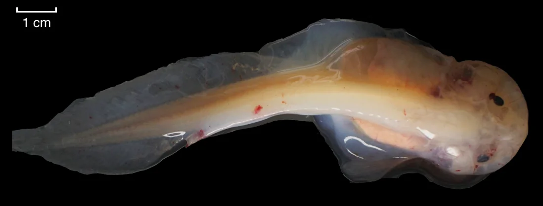
The Mariana snailfish, Pseudoliparis swirei, is a pale, scaleless fish known only from this trench. It was named in 2017 from 37 specimens collected between 6,898 m and 7,966 m, and cameras have recorded it from about 6,200 m to just over 8,000 m; one photograph shows a group gathered at 7,485 m.
Zootaxa (2017) — Gerringer et al., Pseudoliparis swirei sp. nov., a newly-discovered hadal snailfish from the Mariana Trench · Zootaxa (2017) — Gerringer et al., full text PDF (Figure 2: in situ photographs at 6,198 m and 7,485 m) · JAMSTEC — Deepest Fish Ever Recorded, press release of 24 August 2017 (depth range of the Mariana snailfish) · Nature Ecology & Evolution (2019) — Wang et al., Morphology and genome of a snailfish from the Mariana Trench
参考写真。 この深度ではなく、持ち上げられた後に水面で撮影された標本です。 Wang, K. et al. (2019), Morphology and genome of a snailfish from the Mariana Trench provide insights into deep-sea adaptation, Nature Ecology & Evolution 3: 823-833, https://doi.org/10.1038/s41559-019-0864-8 · CC BY 4.0 · Cropped to panel f of the seven-panel figure (pixels 652,776 to 1750,1194 of the original), converted to WebP and compressed; CSS display cropping may apply. 写真のクレジットとライセンス 693 m further down
8,178 m26,831 ftマリアナ諸島にて
Deepest fish filmed in the Mariana Trench
In May 2017 a camera lander set down from the Japanese research vessel Kairei, on a JAMSTEC and NHK expedition, filmed a snailfish at 8,178 m in the Mariana Trench, at the time the deepest fish ever recorded. It swam into view more than 17 hours after the lander reached the bottom and was judged to be a Mariana snailfish.
-
8,336 m27,349 ftそれ以外の海域では
撮影された中で最も深く生息する魚
The record now belongs to another trench. On an expedition that began in August 2022, a snailfish of the genus Pseudoliparis was filmed at 8,336 m in the Izu-Ogasawara Trench south of Japan, and two Pseudoliparis belyaevi trapped at 8,022 m in the Japan Trench became the deepest fish ever caught. Researchers think there may be a limit somewhere between 8,200 m and 8,400 m below which no fish can live, because of the pressure.
University of Western Australia — Scientists break new record after finding world's deepest fish (April 2023) · NOAA Ocean Exploration — What is the deepest-living fish?
2,305 m further down
10,641 m34,911 ftマリアナ諸島にて
シレナ・ディープとマリアナ海溝海洋国立記念碑
This stretch of trench floor, the Sirena Deep, lies inside the Marianas Trench Marine National Monument, which President George W. Bush established on 6 January 2009. The monument covers about 246,600 square kilometres in three units: the floor of the trench, 21 undersea volcanoes and vents, and the waters around the three northernmost Mariana Islands. In July 2011 free-falling cameras filmed xenophyophores here at 10,641 m, single-celled organisms that can grow more than 10 cm across.
U.S. Government Publishing Office — Proclamation 8335 of January 6, 2009, Establishment of the Marianas Trench Marine National Monument (74 FR 1557) · NOAA Fisheries — Mariana Trench Marine National Monument · NOAA Ocean Exploration — The Establishment of the Marianas Trench Marine National Monument · Scripps Institution of Oceanography — Scientists ID Giant Amoebas in the Extreme Deep (October 2011)
-
10,897 m35,751 ftマリアナ諸島にて
底辺での生活
At 10,897 m in the Challenger Deep, baited traps lowered in July 2009 caught 185 amphipods of a single species, Hirondellea gigas, in three hours; these shrimp-like scavengers are 2 to 5 cm long. Video from James Cameron's 2012 dive also showed sea cucumbers and fields of xenophyophores on the bottom.
PLOS ONE (2012) — Kobayashi et al., The Hadal Amphipod Hirondellea gigas · Scripps Institution of Oceanography release, republished by EarthSky — Vibrant mix of marine life found at extreme ocean depths (February 2013)
-
10,908 m35,787 ftマリアナ諸島にて
James Cameron, 2012
On 26 March 2012 the filmmaker James Cameron made the first solo descent to the Challenger Deep, in the one-person submersible Deepsea Challenger, and recorded a depth of 10,908 m. It was the first crewed visit in 52 years.
Oceanography (2021) — Loranger, Barclay & Buckingham, Implosion in the Challenger Deep (history of descents and depth estimates) · Woods Hole Oceanographic Institution — HOV Deepsea Challenger
-
10,916 m35,814 ftマリアナ諸島にて
トリエステ、1960
On 23 January 1960 Jacques Piccard and US Navy Lieutenant Don Walsh rode the bathyscaphe Trieste to the floor of the Challenger Deep, the first people to reach it. The descent took nearly five hours and they stayed about 20 minutes. Their instruments read 11,521 m, a figure later corrected to about 10,916 m.
U.S. Office of Naval Research — Navy celebrates 60th anniversary of deepest ocean dive (January 2020) · Oceanography (2021) — Loranger, Barclay & Buckingham, Implosion in the Challenger Deep (history of descents and depth estimates)
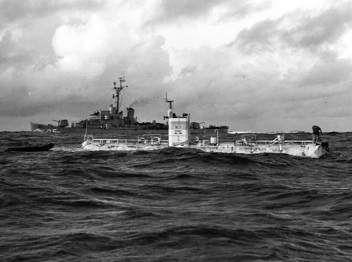
参考写真。 ダイビング当日の水面で撮影されたものであり、この水深ではありません。 U.S. Navy photo NH 96797 · Public domain · Resized to at most 1200 pixels wide, converted to WebP and compressed; CSS display cropping may apply. 写真のクレジットとライセンス -
10,925 m35,843 ftマリアナ諸島にて
Limiting Factor, 2019 onward
On 28 April 2019 Victor Vescovo piloted the submersible Limiting Factor to 10,925 m, give or take 4 m, and went back three days later, the first person to reach the bottom twice. The same vessel has carried others since: on 7 June 2020 Kathryn Sullivan became the first woman to reach the Challenger Deep, and on 11 March 2021 Nicole Yamase of the Federated States of Micronesia became the first Pacific Islander.
Oceanography (2021) — Loranger, Barclay & Buckingham, Implosion in the Challenger Deep (history of descents and depth estimates) · Guinness World Records — First woman to reach the Challenger Deep · University of Hawaiʻi News — 1st Pacific Islander to reach ocean's deepest point is UH grad student (April 2021)
-
10,935 m35,876 ftマリアナ諸島にて
チャレンジャー・ディープ
The deepest known point in the ocean lies 10,935 m (35,876 ft) down near the southern end of the Mariana Trench, about 545 km southwest of Saipan, in waters of the Federated States of Micronesia. The figure comes from pressure measurements made on submersible dives in June 2020 and is good to about 6 m either way; other recent estimates, most of them from sonar, range from about 10,920 m to about 10,985 m. The water here presses with roughly 1,100 atmospheres.
NOAA National Ocean Service — How deep is the ocean? · NOAA Institutional Repository — Greenaway et al. (2021), Revised depth of the Challenger Deep from submersible transects · Oceanography (2021) — Loranger, Barclay & Buckingham, Implosion in the Challenger Deep (acoustic depth estimate) · University of Hawaiʻi News — 1st Pacific Islander to reach ocean's deepest point is UH grad student (location within the FSM exclusive economic zone)
最下部。
下り道で撮影された一枚一枚の写真は、意図的に探し求めた人々によって撮られたものであり、彼らがそれを見つけたのは、まさにその深みのある場所でした。
Photo credits and licences are listed with each picture and on this page: 情報源・写真クレジット